\[ \newcommand\si[1]{\mathrm{#1}} \newcommand\SI[2]{#1\,\si{#2}} \newcommand\matr[1]{\mathbf{#1}} \DeclareMathOperator*{\argmax}{arg\,max} \DeclareMathOperator*{\argmin}{arg\,min} \]
GIS data analysis 2
1 Reclassification
Reassigns pixel values in raster to simplify the raster.
For example, cells with values = forestry (value 10) should take a new value of 1.
Cells with values not equal to forestry should take a new value of 0.
Creates a newly coded simple raster.
2 Zonal statistics
Raster GIS filter operations
3 Moving average
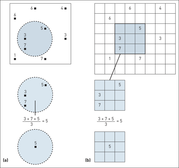
(a) Moving average in vector; (b) Moving average in raster
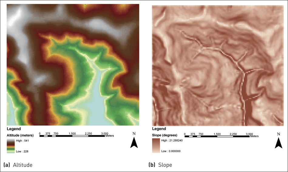
4 Slope
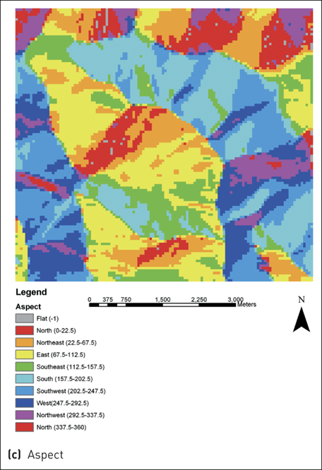
5 Aspect
6 Hillshade
Example of cartographic hillshading techniques
7 Solar radiation
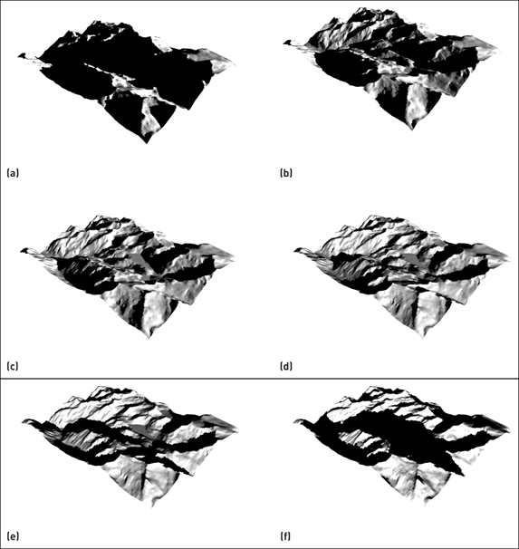
Modelling incoming solar radiation in Happy Valley (a–d) representing morning to evening during a winter’s day
8 Line of sight
Ray tracing for visibility analysis
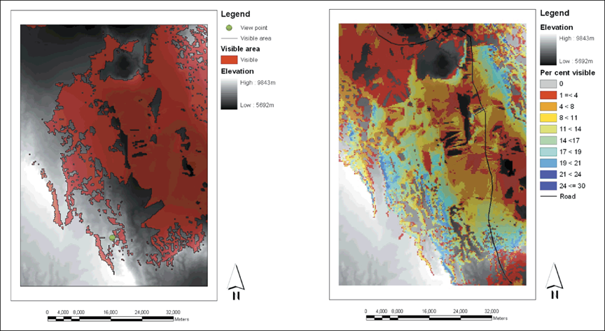
9 Viewshed
Results of viewshed analyses for single point and linear feature
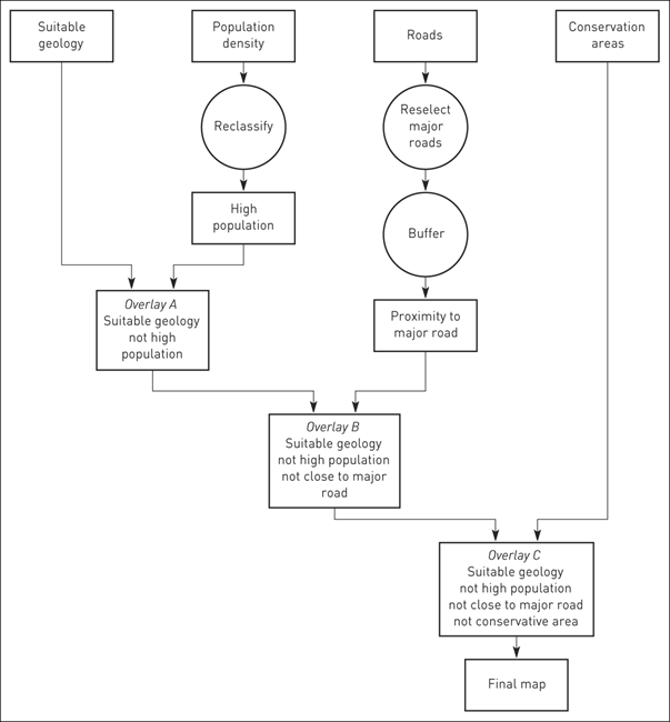
10 Suitability analysis for a nuclear waste repository
11 Exercises
Find some sample layers from nc_spm_08_grass7_exercise.gdb.zip.
11.1 Exercise: NLCD reclassification
Download the NLCD data and reclassify subtly different subclasses of the same class into their parent classes.
11.2 Exercise: DEM reclassification
Reclassify the elevation raster in nc_spm_08_grass7_exercise.gdb.zip into lower (0–1/3 of the elevation range), medium (1/3–2/3), and higher (2/3–1).
11.3 Exercise: Major NLCD classes within a radius
Find major NLCD classes within a 100-meter radius of each cell
11.4 Exercise: Major NLCD classes by census block
Find major NLCD classes by census block in nc_spm_08_grass7_exercise.gdb.zip.
11.5 Exercise: Slope
Calculate the slope of the elevation raster in nc_spm_08_grass7_exercise.gdb.zip.
11.6 Exercise: Aspect
Calculate the aspect of the elevation raster in nc_spm_08_grass7_exercise.gdb.zip.
11.7 Exercise: Hillshade
Calculate the aspect of the elevation raster in nc_spm_08_grass7_exercise.gdb.zip.
Overlay the hillshade layer over the elevation layer and adjust its transparency.
12 Exercise: Solar radiation
Model incoming solar radiation (insolation) into the elevation raster in nc_spm_08_grass7_exercise.gdb.zip.
13 Exercise: Line of sight
Calculate the light of sight on the the elevation raster in nc_spm_08_grass7_exercise.gdb.zip.
Any issues? I have one.
14 Exercise: Viewshed
Calculate the viewshed on the the elevation raster in nc_spm_08_grass7_exercise.gdb.zip.

