Accessing raster data using ArcPy
Institute for Environmental and Spatial Analysis...University of North Georgia
Contents
1 ArcPy modules
arcpy.mp: Mapping modulearcpy.sa: Spatial analyst modulearcpy.da: Data access modulearcpy.na: Network analyst modulearcpy.sharing: Sharing modulearcpy.wmx: Workflow manager module
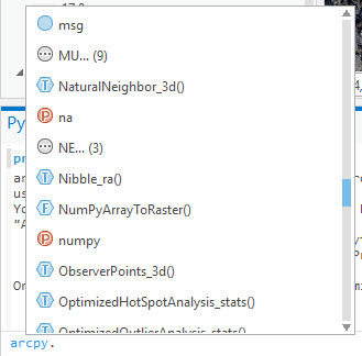
2 ArcGIS Pro Python window interface
3 Help
help(arcpy)
help(arcpy.mp)
help(arcpy.mp.ArcGISProject)4 Project
In most cases, we start from an ArcGISProject object (a project).
# specific project
prj = arcpy.mp.ArcGISProject(r'P:\YOUR_PATH\Project.aprx')

# current project
prj = arcpy.mp.ArcGISProject('CURRENT')

# help on an object?
help(prj)5 Maps
An ArcGISProject may contain multiple Maps.
# all maps
for m in prj.listMaps():
    print(m.name)

# active map
m = prj.activeMap
print(m.name)6 Layers
Usually, there are multiple Layers in a Map.
# all layers in the active map
for lyr in m.listLayers():
print((lyr.name, lyr.dataSource, lyr.isRasterLayer, lyr.isFeatureLayer, lyr.isWebLayer))7 Raster data
7.1 Add raster layers
Add your own raster layers or create a new one.
# let's export the current map as a color TIFF
filename = r'P:\YOUR_PATH\map.tif'
width = height = 1024
m.defaultView.exportToTIFF(filename, width, height, geoTIFF_tags=True)

# add the TIFF to the map
m.addDataFromPath(filename)7.2 Raster
This is how you find a raster Layer and get its Raster object.
# find the first raster layer
for lyr in m.listLayers():
    if lyr.isRasterLayer:
        break

# get the raster object
ras = arcpy.Raster(lyr.name)
print(ras.name, ras.extent)7.3 Raster attributes
A Raster object has many useful attributes.
# all attributes not starting with _
for i in dir(ras):
    if not i.startswith('_'):
        # ras.attribute_name is equivalent to getattr(ras, attribute_name)
        # why use this syntax? when attribute_name is string
        # e.g., ras.extent == getattr(ras, 'extent')
print((i, getattr(ras, i)))7.4 Raster to array
The Raster object does not expose its cell values as an attribute.
Then, how can you access/manipulate the cell values?
Convert the Raster object to a NumPy array. NumPy arrays are a GIS-agnostic data type. We can use NumPy functions to modify raster cells.
arr = arcpy.RasterToNumPyArray(ras)
print(arr)7.5 Raster bands
Some raster Layers have four bands including red, green, blue, and alpha.
print(arr.shape)7.6 Modifying cell values
Just use the NumPy array to change cell values.
# clone arr
arr2 = arr.copy()

# set the entire red band to 0
arr2[0] = 0

# set the green band at cell (50, 60) to 255
arr2[1][50][60] = 2557.7 Save raster
Save the NumPy array as a raster file.
filename2 = r'P:\YOUR_PATH\map_wo_red.tif'
ras2 = arcpy.NumPyArrayToRaster(arr2, ras.extent.lowerLeft, ras.meanCellWidth, ras.meanCellHeight)
arcpy.CopyRaster_management(ras2, filename2)
m.addDataFromPath(filename2)